Sorted by date Results 1 - 8 of 8

I am preparing for a short jaunt, four or five days on the PCT. Weather has cooled, and the trail is calling. My right brain tells me "You can just load up and head out...you have done this many times, you know what to take". Fortunately my left brain says: "No! Silly one, make a checklist". Alright lefty, here goes: Shelter, food, and water is really all one needs, but I like to have a little, OK, a lot of comfort, so here I go. Gregory Backpack North Face Sleeping bag ThermoRest self inflating...

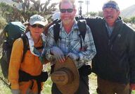
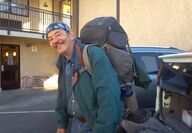
Who are these people strolling the streets of Tehachapi, looking a bit dirty, suntanned, bearded, having backpacks, close enough at the right time of day, body odors. PCT Packers they are. Trail mile 558 is at the Cameron Road and Willow Springs junction, 10 road miles east of Tehachapi. Most began their pilgrimage at the border of Mexico in mid April, and Tehachapi is only a few miles short of their first ¼ of the journey. Tehachapi is a way-point on the trail. Here they resupply, mail a...

The PCT, the pathway generating adventures for intrepid hikers. From the border of Mexico to the border of Canada. Official mileage: 2,560. Many attempt the trek in one season, north bound (NOBO) from Mexico, or south bound (SOBO), from Canada. Some perform what is referred to as a YOYO. Mexico to Canada, then back in one season. Some attempt to accomplish speed records, fastest time to date: 60 days, 17 hours,12 minutes! Unlike the quickly moving through-hikers, I chose little steps at a time,...

All it takes to make a transformation of something ordinary to something spectacular is a bit of work, a bit of money, and a whole lot of time. It is worth it....

There are countless ways of exercising: the gym, walking, swimming, jogging, Jazzercise, Yoga, Tai Chi and the list goes on and on. The basic concept is: eat right and exercise. I know, I have tried so many. Spring is here, the weather warms and calls me to the trail. I have experienced a ten pound weight loss in four weeks, and my muscle-to-fat ratio has made a dramatic improvement, it feels so good. This little exercise has led to many things, including: a touch with my spiritual side, a...

The Pacific Crest Trail, the Mexico to Canada footpath flows wild and rugged, while turning and twisting atop the backbone of the mountains of the American West. She calls so clear and loud. She calls: "Join me". Since my last article, I trekked south to the San Gabriels for a fun 16 mile jaunt. For my journey, I started at trail mile 403 to the Mill Creek Ranger Station at mile 418, where my Angel picked me up. I took a hard look at my 40 plus pound backpack: lifted it to my knee, put my left...

Last issue I left you with time for a pause. During this pause I learned a bit about the Tehachapi Trail Angels. The Pacific Crest National Scenic Trail 2000, commonly known as the PCT, is a pathway that leads intrepid backpackers from the border of Mexico to the border of Canada – over 2,500 miles. A few attempt to cover the long distance in one journey. Most, like myself, do what is called "section hiking." (A little bit here and a little bit there.) I have also volunteered as a local "...

"The Trail" is the Pacific Crest Scenic Trail (PCT). It begins at the Mexican border, travels north through some of the most beautiful, at times the most dreadful, most picturesque and sometimes untidy scenes of the western edge of North America. Mountains, lakes, rivers, streams, wildlife, deserts and too many small things to mention are along the trail that wanders up-and-down and left-and-right, then ends up some 2,650 miles later. I chose to be a "section hiker." Little bites here and there...