Tehachapi's Online Community News & Entertainment Guide
Tehachapi's Online Community News & Entertainment Guide
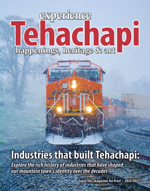
My standard Jantar 72 A S when the poppies are in full bloom.
Like most kids born in the 1950s, I wanted to learn to drive as soon as I could reach the gas and brake pedals. I also wanted to learn how to safely target, trap, shoot and receive aircraft flight instruction.
I lived near El Monte airport in the San Gabriel Valley when I was 13 years old. I would ride my bike down to watch the take-offs and landings of all kinds of aircraft.
My uncle Jim had pilot friends who owned a Beachcraft Bonanza. I was invited on a trip to Las Vegas in the aircraft, where I got a little airsick in the backseat. This was because I should have been watching the horizon and keeping my field of vision straight ahead. The Beachcraft Bonanza is a V-tailed aircraft and it's known for a yawing motion caused by the V-tail, which can induce motion sickness in some people.
On the return trip, the pilot let me ride in the co-pilot seat and fly. I got to handle the flight controls and was able to fly most of the return trip. I followed along with the pilot on the take-off. You just set a pitch and you are air-born. No more motion sickness for me.
I was hooked on aviation and in 1983, on a trip to the Tehachapi Valley I found Fantasy Haven Gliderport (which is today known as Mountain Valley Airport). Tehachapi is one of the worlds best soaring locations and known for many high altitude records in sailplanes. I started working at Edwards Air Force Base as a flight line photographer, then working in auto testing. I lived in Tehachapi and began getting my commercial glider rating.
I did over 1,800 commercial rides for our local sailplane port. You learn a lot about yourself and about life doing sailplane rides with strangers. I have a few stories about these rides, but I will save those for another time.
I progressed in aviation and I found a high-performance, used fiberglass sailplane called a Standard Jantar "SZD-41 A" for sale. The SZD-41A glider was designed by W. Okamus and made in Poland starting around 1973. The Jantar is 15-meter with a little more than 49-foot wingspan and a retractable landing gear. This is about a 800-pound gross-weight aircraft with me in it.
My "N" number was 72 AS and I do miss flying my Jantar. The Jantar's max glide ratio is 39.5 to one. The glide ratio means the distance forward traveled divided by the altitude lost in that distance. Then you add in the sinking air rate affecting the distance you go. This is why when you plan your flights, you always use half of that 39.5 to one glide ratio. You could hit a large area of sink and be looking for a place to land. This could be an issue with lower performance training gliders so "ultra" conservative flying is needed with this class of glider. Some sailplane pilots fly very aggressively at the edge of the performance of the aircraft. I did not go this route.
Sailplane pilots maximize their time in air going up in the thermal lift, so we fly at slower speeds in lift. In sinking air, we fly faster. If you see sailplanes in the Tehachapi Valley turning and going up, they are in lift. I had many fun, fantastic, safe flights in my Jantar flying up the Southern Sierra Nevada mountain range. Most of my flights started getting a tow out of the sailplane port to about 1,500 feet above the ground, trying to hit lift right away. I would wait for the best conditions in Tehachapi Valley on a summer day with a low-pressure system in place. If it's 105 degrees or more in Bakersfield, that could be a good indicator of thermal production for us in Tehachapi. Tehachapi is normally around 10 degrees cooler than Bakersfield.
There are many ways to predict if it's a good soaring day. I would call the National Weather Service in Hanford, California. You can gain tons of knowledge from the smart meteorologists who work there. I would talk with Dan G. back then, who was a glider flight instructor, too. San Joaquin Valley Forecast Office at http://www.weather.gov is good, too. You could also call 1-800-WX-BRIEF for weather information.
A low-pressure system has unstable air which is normally great for lift and thermals. Differential heating of the earth induces the warmer air to go up and the cooler air to sink.
One funny thing I found out here in Tehachapi, the places with big parking lots produce the best lift. It's the darker surfaces that help with thermal production, as well as the uneven heating of the earth, plus the topography of the hills, mountains, farming, etc. Wind and its direction play in as well, kicking off thermals.
With just a 1,500-foot tow above our valley, I could easily find lift most of the time. Climbing up to 16,000 above sea level, I would head north in the direction of Inyokern Airport, which is about 60 miles from Tehachapi by air.
Hey, working with a plane with no motor, I was happy just to do a 60-mile glide. Inyokern Airport had another sailplane club/operation at that time. I could get a tow there if needed during their 9 to 5 operations in the event I had to land there – which I almost did on one flight.
Another thing about Inyokern Airport: Inyokern Drag Strip was one of the original drag strips in California from 1954 to 2005. The airport would use the glider runway/taxi way to launch gliders when not used for racing. The drag stirp closed due to the Federal Aviation Administration mandate, but the last drag race was on April 9, 2005.
My normal planned flight was to Inyokern Airport at an elevation of 2,400 feet. I got a great indicator of the day's weather conditions. Then, if the lift was good, I would head to Lake Isabella, Kern Valley Airport at an elevation of 2,600 feet with over a 3,000-foot runway there if needed. I used highways 178 and 14 as a turn reference point. On most good days I could cruise at altitudes of 12,000 to 17,999 feet above sea level, always keeping in mind places to land if I ran into bad sinking air. There are many great landing spots along Highway 395 in that direction, as well. Back then my wife and I would check out the landing spots by car up Highway 395 and walk the dirt strips making sure they were safe for a sailplane to land on.
I had on board aviation oxygen to breathe. FAA rules state you have to use O2 at 12,500 feet after 30 minutes. I would go on O2 at 10,000 feet. The O2 keeps you very sharp and feeling great so you don't get oxygen starvation at the high altitudes.
See part 2 in a future issue of The Loop newspaper.